Solar Tracker
The Best Way to Utilize Solar Energy
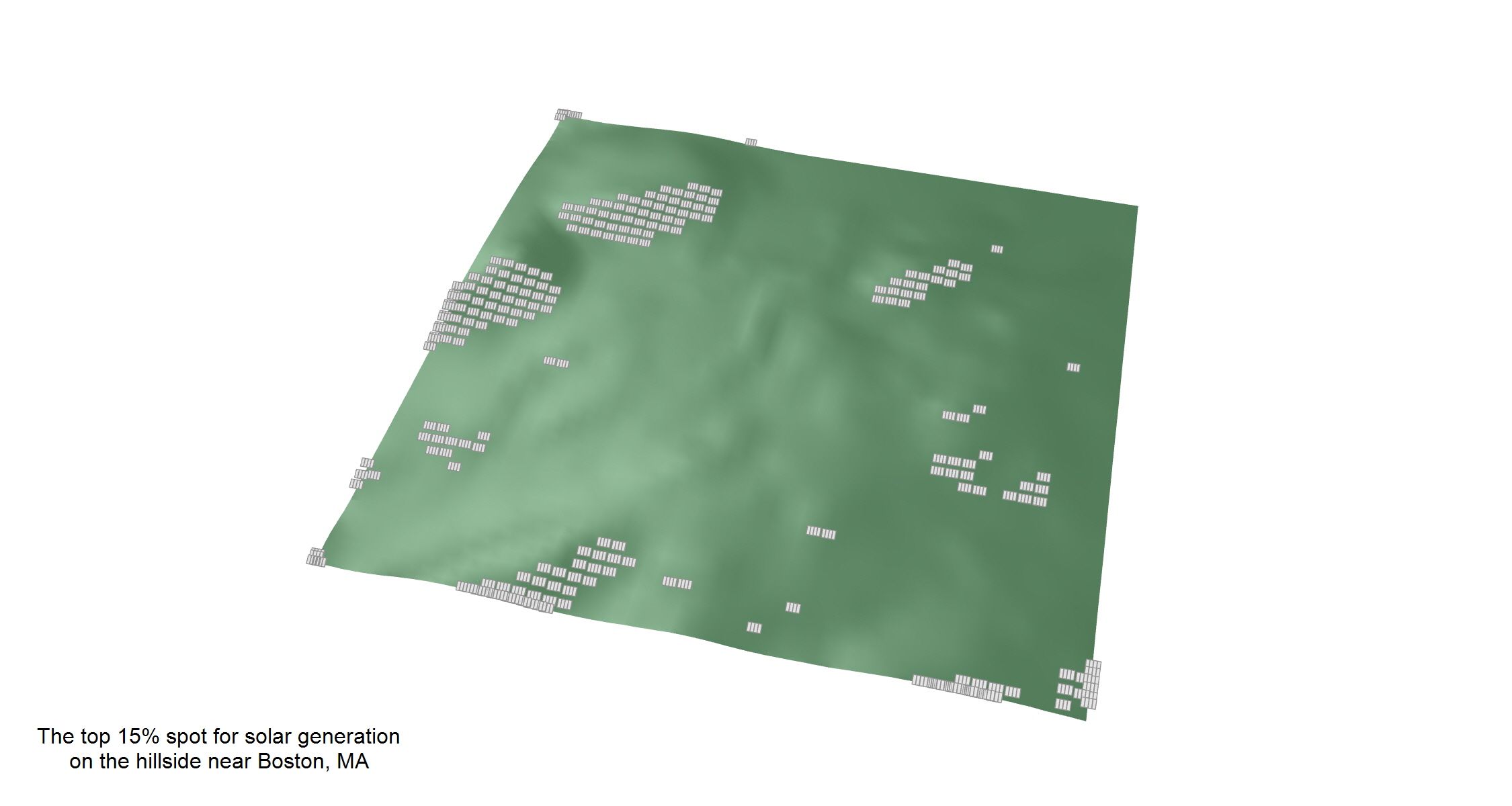
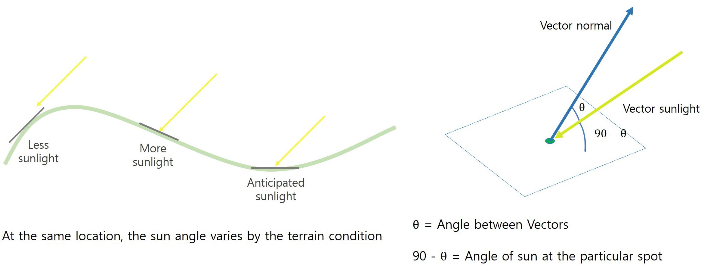
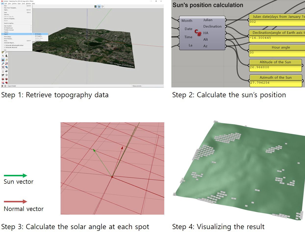
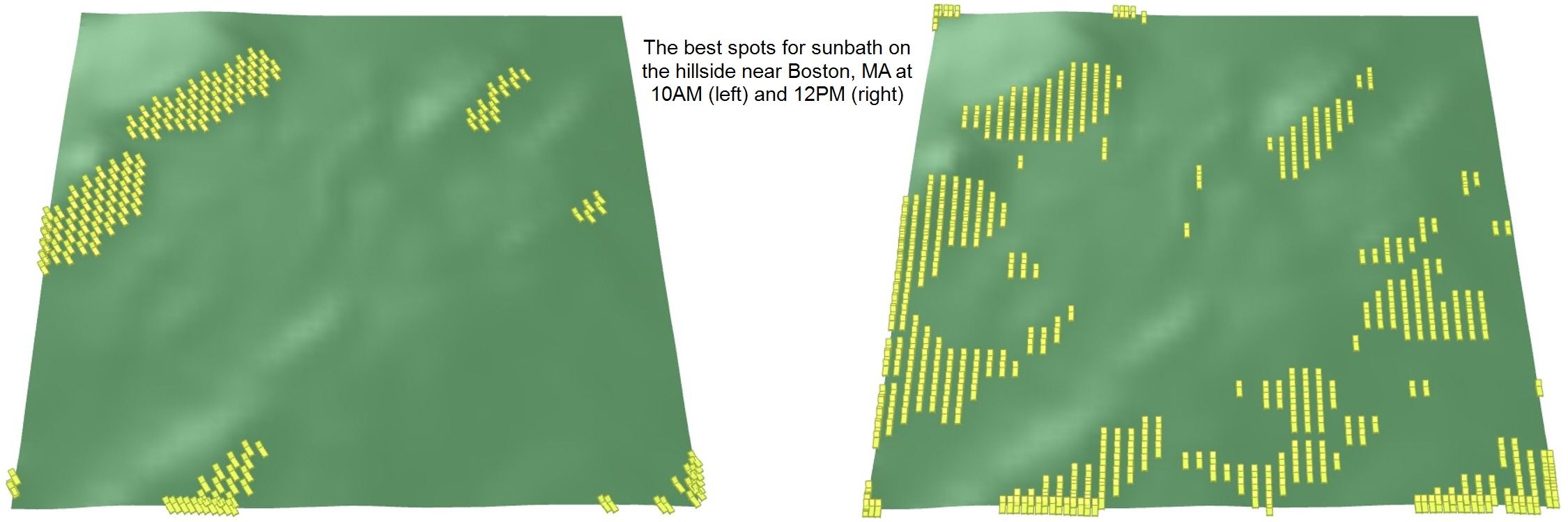
Have you ever thought which spot we can get the most sunlight? The spot that is perpendicular to the solar radiation is the place we can get more sunlight that the flat surface. What if we can find that specific spot and go for sunbath or place the solar penal and make the most profit? The Solar Tracker use the Google Map topography data that you choose and analyze the best spot at the certain time or annually.
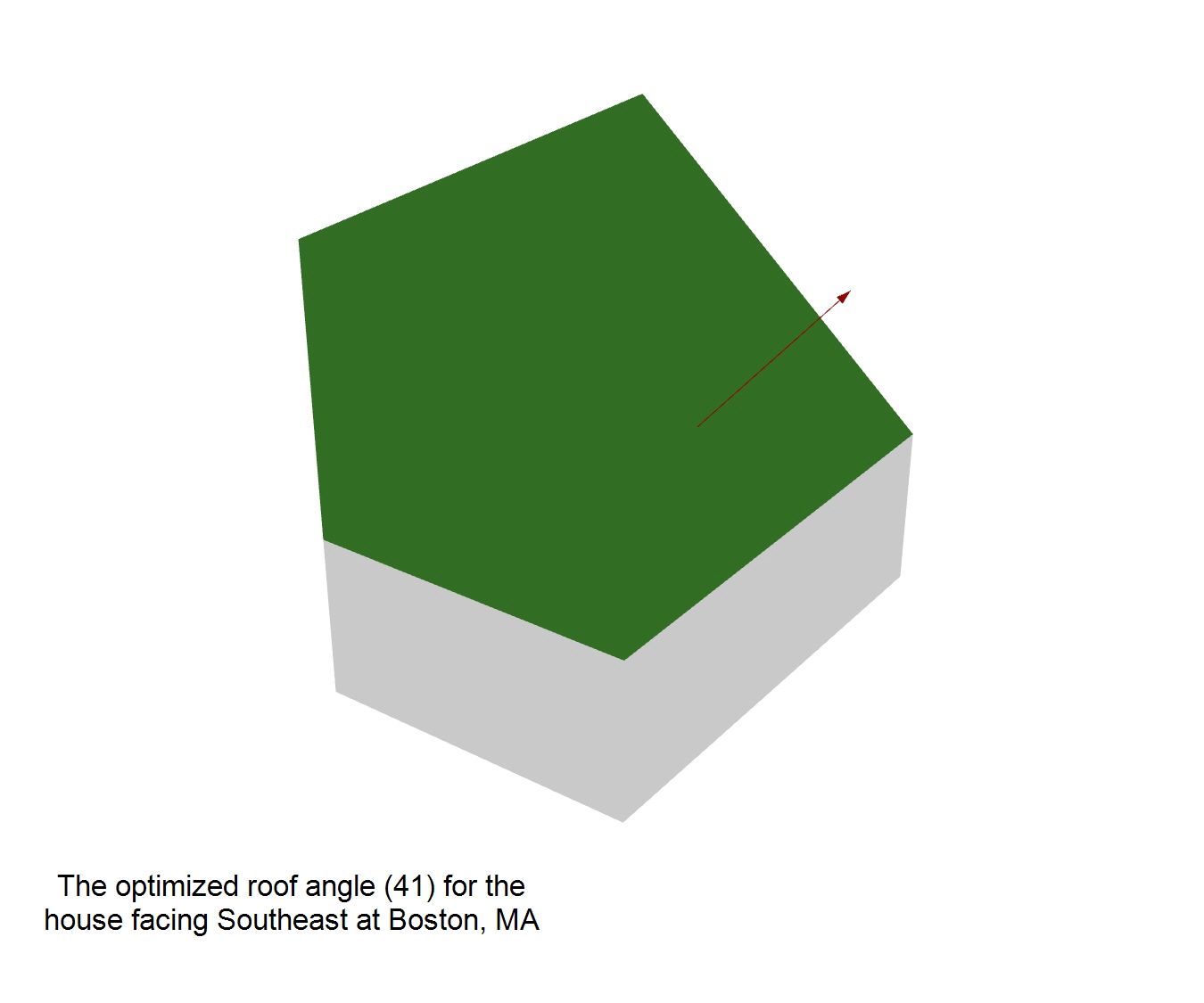
The Solar Tracker not only find the best spot for the solar generation, but also help to save the cost of the supporting structure, maximize the land use by minimizing the interference of shadow between the panels, and visually integrate the solar panels to the topography. The last function of the Solar Tracker is related to the rising popularity of the solar panel on the roof. It assists the architects in the early design stage to know what the most efficient angle of the roof is when the location and orientation of the house or building are considered.