AIN'T NO MOUNTAIN HIGH
Slope Definer for Hiking Paths

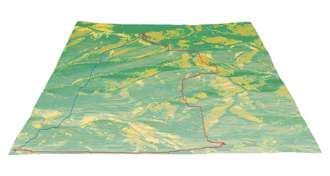
Ain’t No Mountain High looks at one of the most idiosyncratic question in traversing a hilly or mountainous landscape: how does one go from point A to point B via a path of least resistance? Evidently, this meant that a path takes shape as a negotiated outcome between the shortest distance of travel and the slopes of the terrain. To seek out the definition of “least resistance” therefore, becomes a task by which steepness and gentleness of a given landscape are profiled, onto which the plotting of shortest travel distances also takes into the account of slopes.
By using the example of Mount Roosevelt of Vermont and its surrounding areas, this project would manipulate the thresholds of “gentle”, “intermediate” and “difficult” slopes, and reconstruct the landscape from its slope-segregated patches based on customized inputs of slope ratio denominators. When used in conjunction with an existing, proprietary component that calculates the shortest distance, the project - as a component of its own - provides customizable filtering of the base geometry, from which a path of least resistance may generate.

