Frisbee Mountain Range
Topographical Designs from Frisbee Spins

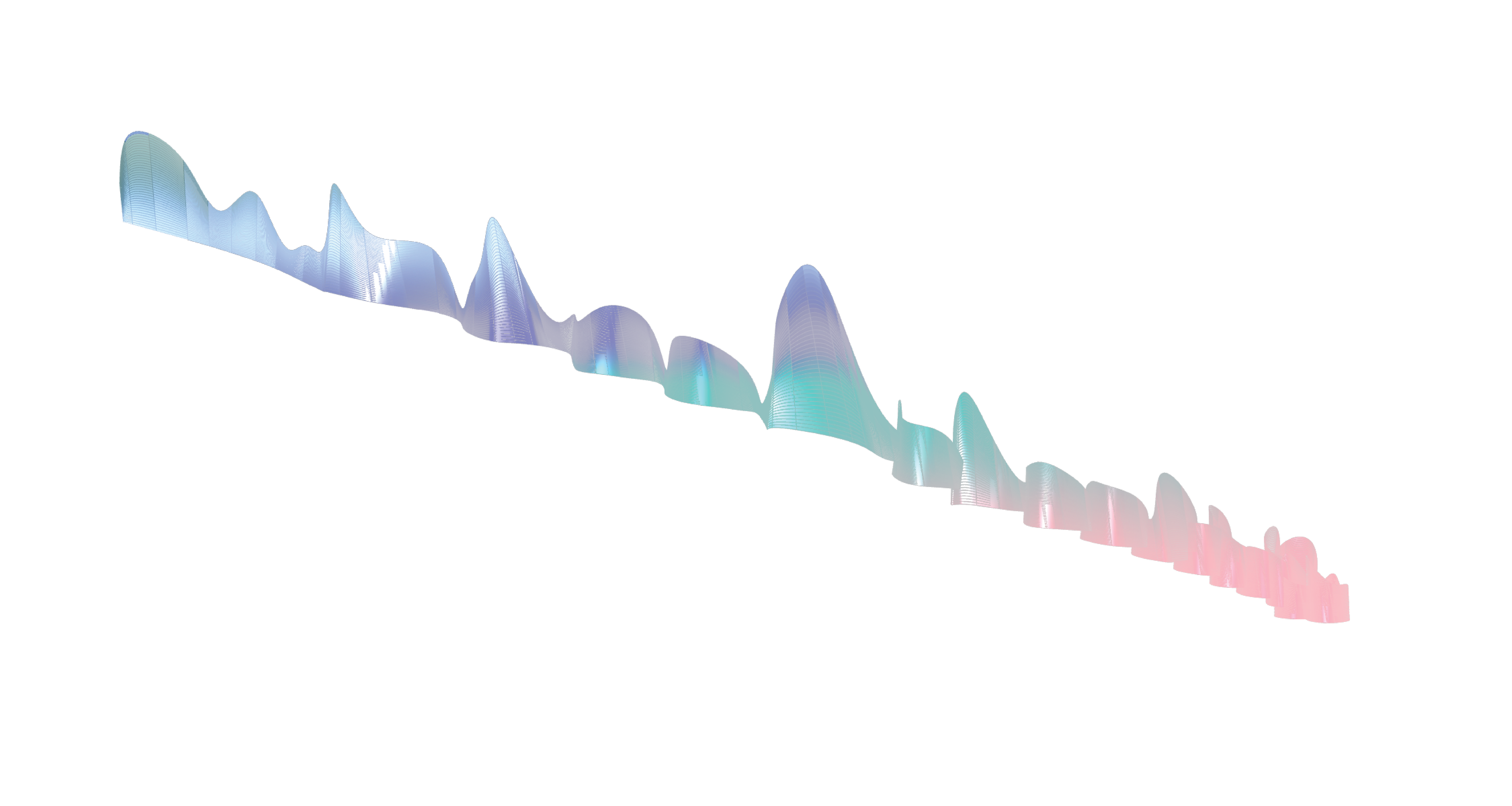
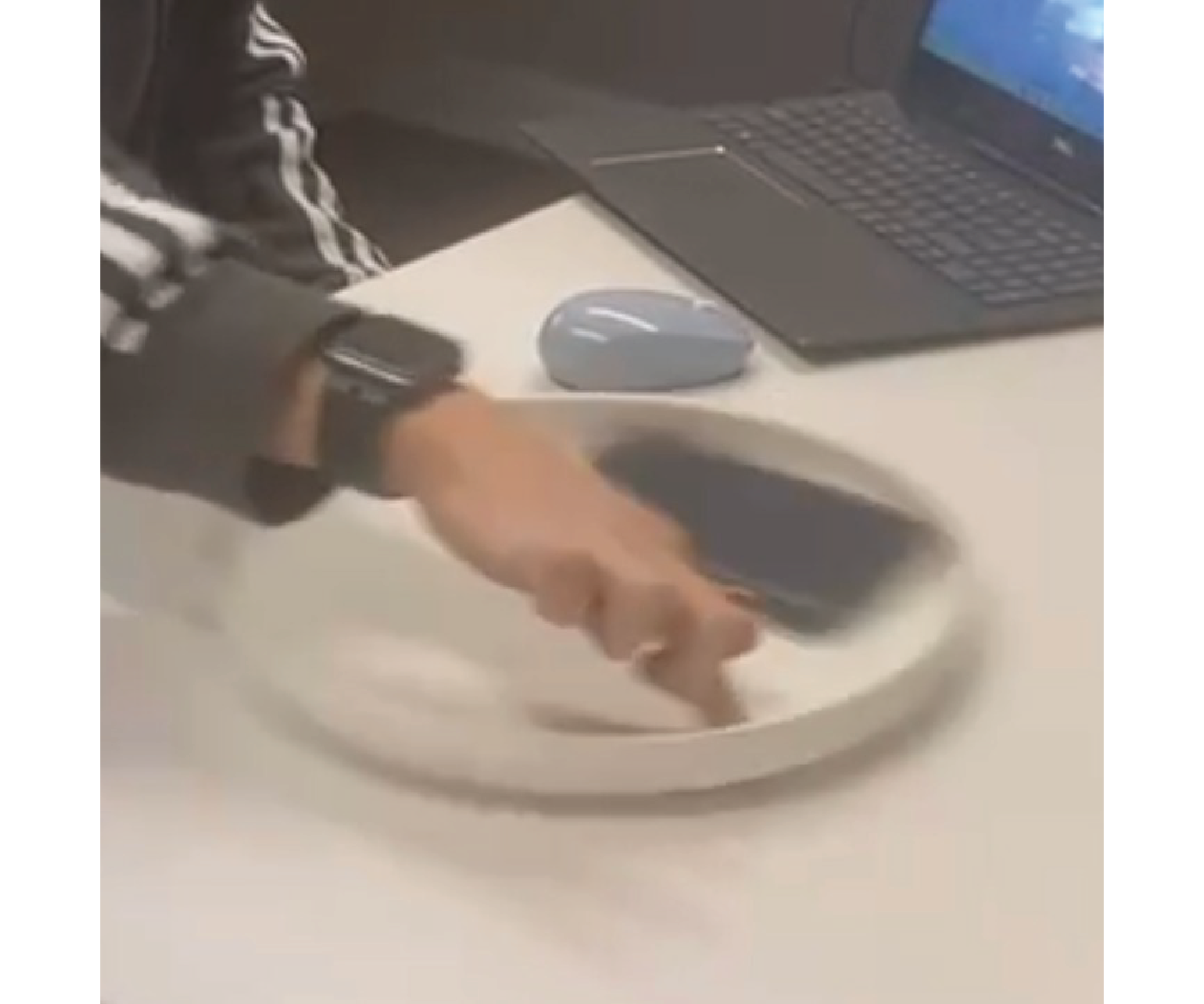
For this project, the Frisbee Mountaineers placed a phone running Fologram inside a Frisbee sitting flat against a table. We spun the frisbee in place, recording the motion of the phone as it went along for the ride. We were particularly interested in exploring the variations in speed of the phone’s motion along its roundabout journey; and so we scripted a vector, perpendicular to the plane at each data point, that visualizes the rate of speed in terms of the line’s magnitude.
Since the phone spun inside the frisbee on a flat surface (x axis in the rhino environment), each plane generated in the sequence was perpendicular to the x-axis, causing the lines perpendicular to those planes to extrude outward on the x-axis. In order to summon these lines up along the z axis and turn them into mountains, our script translated these vectors by multiplying the inverse of the line distance values (height*-1) with the y-axis of the corresponding plane. We then set the line endpoint as the sum of the origin plus the translation.
Finally, to add some flair, we visualized each peak’s distance from the “ground” plane with a color gradient!


