Topodune
Morphing Terrain Using Werner Dune Algorithm
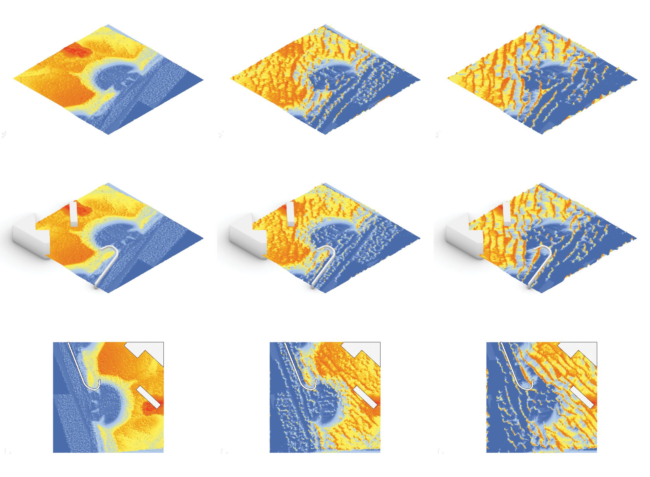
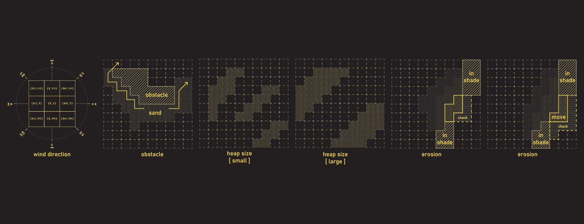
TOPODUNE is a web-based, interactive tool for simulating the effects of wind-based erosion and dune formation on topographic data. It employs a method based on the Werner algorithm for modeling aeolian dunes, which checks pixel-by-pixel if a sand particle is (1) in shadow, (2) has a slab that could be eroded (3) how far the slab could be eroded (4) the speed and distance with which to carry the eroded material. This method for visualizing spontaneous land forming from the movement of sediment provides an opportunity for landscape architects to represent change in time to a landscape that would otherwise be hard to realistically render. These terrain manipulations can have a range of applications, from representing sedimentation in harbors and in riverbeds to the change of dune landscapes over time.
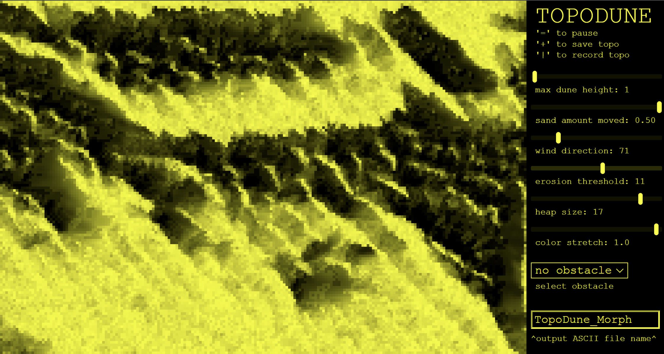
TOPODUNE allows users to control parameters determining wind direction, sand moved, dune heap sizes, erosion thresholds, max dune height, and visualization, and the sand’s interaction with a selection of landscape obstacles. It takes ASCII GRID topographic data types - compatible with ArcGIS Pro and Rhino using the Ibex plugin, and topographic manipulations can be saved as single ASCII outputs or recorded as frames to make animated visualizations.