Planetary Skin
Surveilling/Surveying Landscapes

Contemporary understandings of planetary ecologies are shaped by vast networks of remote sensing technologies. This infrastructure forms, in the words of Karen Barad, a “planetary skin” that mediates and frames scientific inquiry and collective action in our time of environmental catastrophe. In this system, no datum is more ubiquitous than the pixel, captured through ever-expanding networks of surveillance systems and mobile devices.
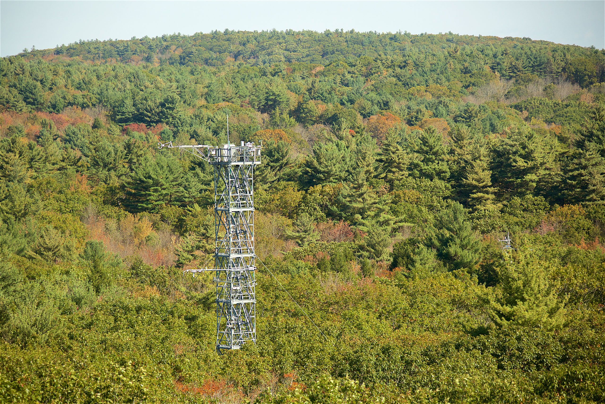
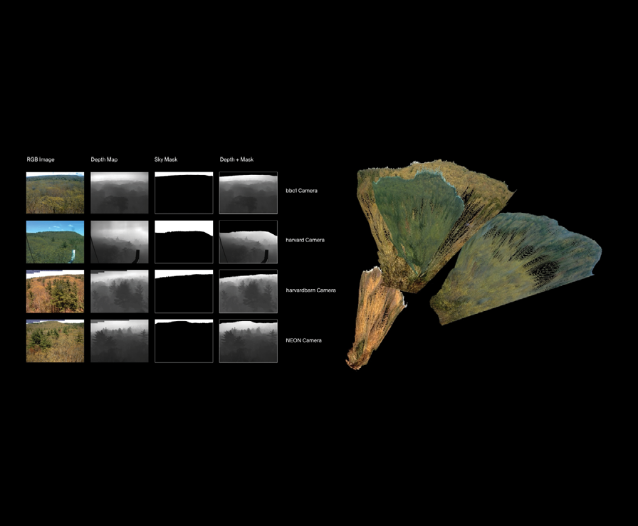
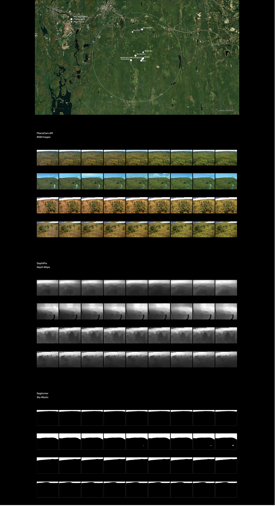
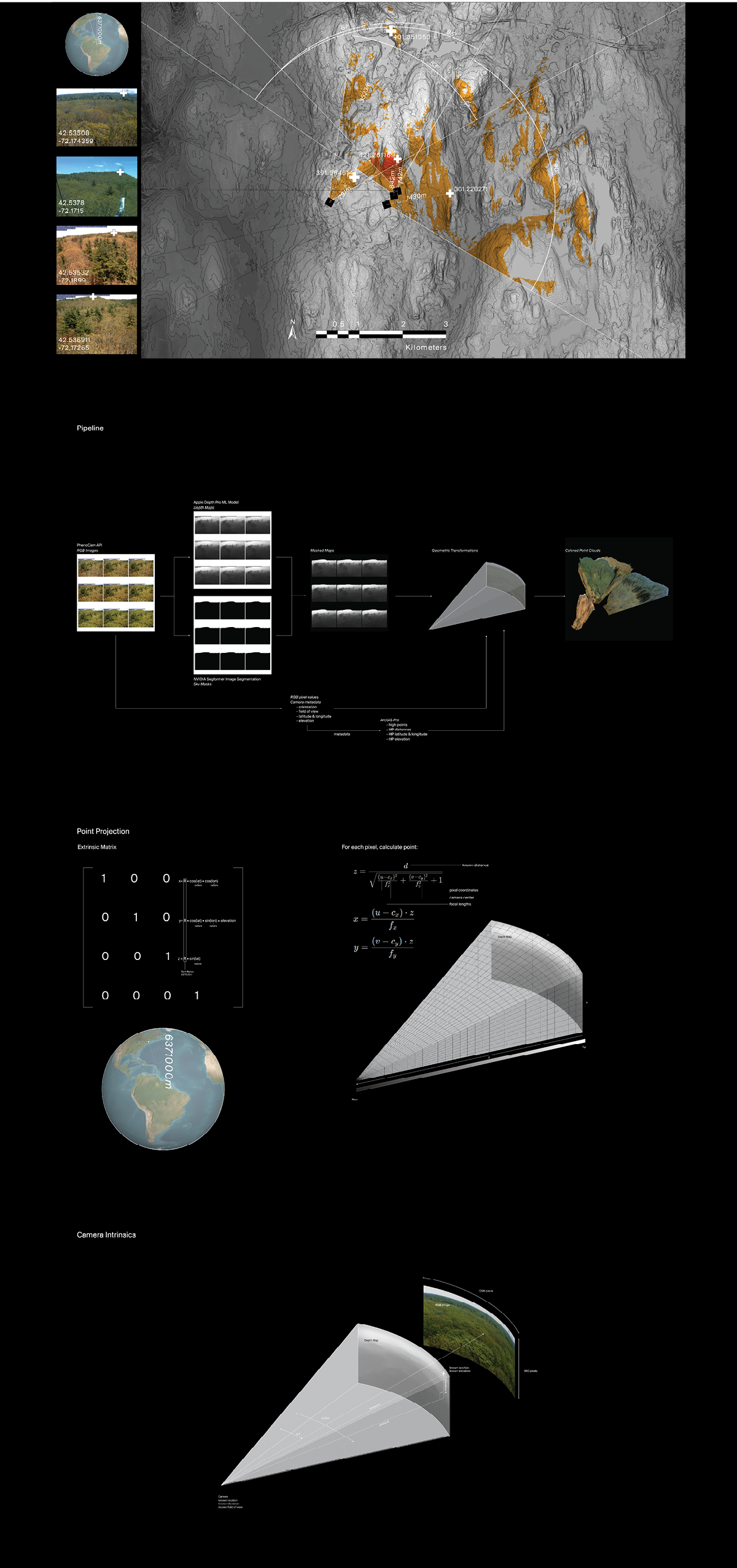
This work is an experiment leveraging the PhenoCam network—a global surveillance system for monitoring forest carbon cycles and benchmarking satellite imagery—as the foundation for a computer vision pipeline capable of transforming live photographic data into 3D terrain models. By connecting to PhenoCam’s open API and processing RGB images through Apple Inc.’s Depth Pro prediction and PyTorch’s Segformer machine learning models, the resulting masked depth maps and camera metadata are used to geometrically calculate colored point clouds from pixel data.
Refining this process further could not only contribute to scientific studies but also narrow the perceptual gap between landscape images and lived geographies. Scaled up to encompass the entire PhenoCam network, this “planetary skin” could become as much a digital artifact as it is a conceptual metaphor.


